
Yes, you guessed it we headed out on yet another local walking adventure this weekend, to Lamaload Reservoir, via Macclesfield Forest. This is the first feature of our Peak District Bucket List and its certainly a beautiful one!
Our route started at the St Stephen C Of E Church Forest Chapel, Macclesfield, SK11 0AR, onto Lamaload Reservoir. 30 minutes into the walk we realised that this was going to be hilly walk. However as we like to say “With every up hill, comes a down hill”, which basically means we can stop and have a rest!!
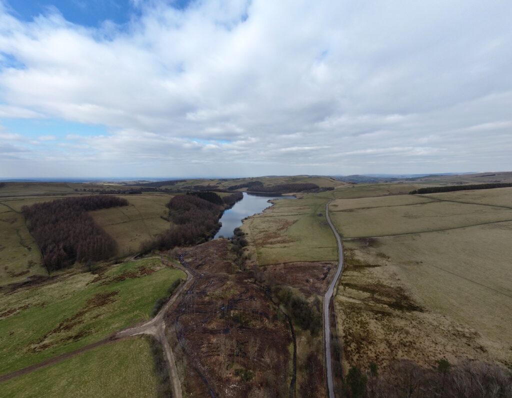
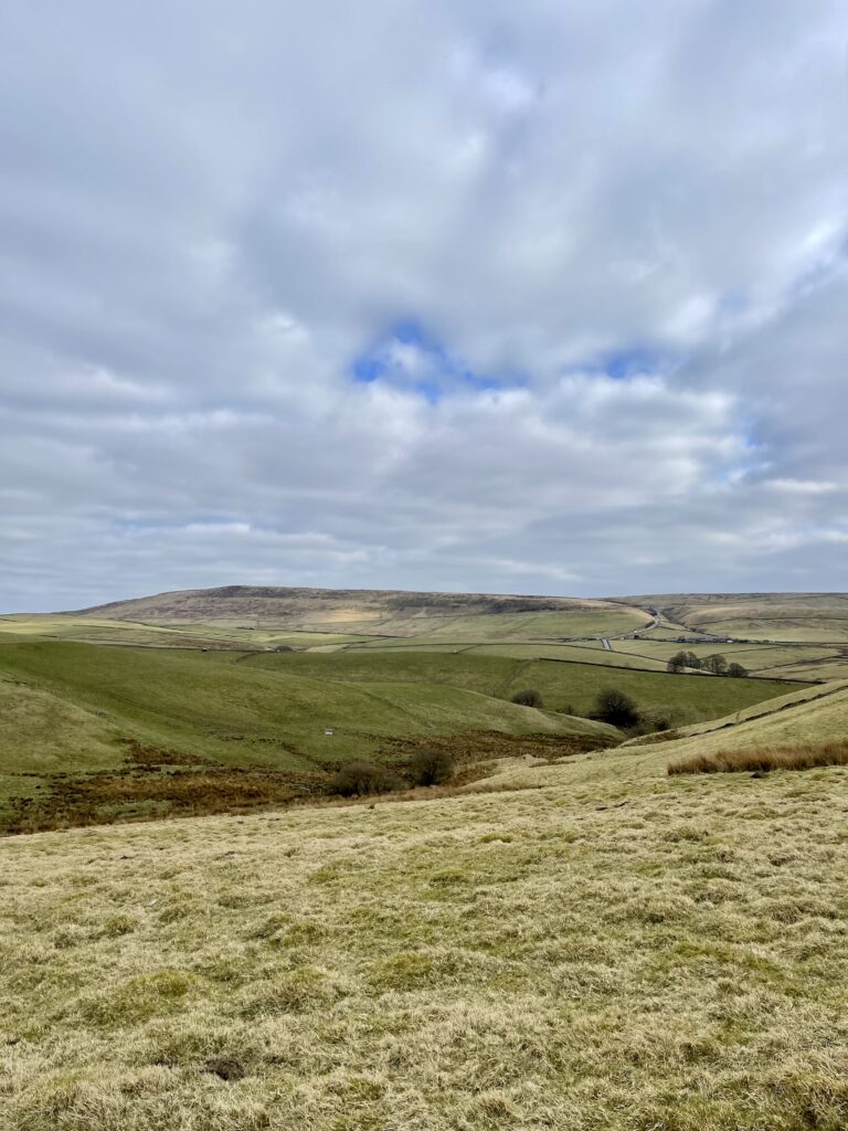
Unfortunately as there is no direct route around all the Reservoir we only got a slight glance of Lamaload Reservoir, but this is when having a drone is SUPER helpful. We are drawn to water, which maybe because we are stuck in the middle of England, so any chance of getting to some form of water feature is a must for us! Lamaload Reservoir is situated near Rainow, Cheshire. It lies in the South West Peak within the Peak District National Park, to the west of the Goyt Valley, and is fed by the River Dean.
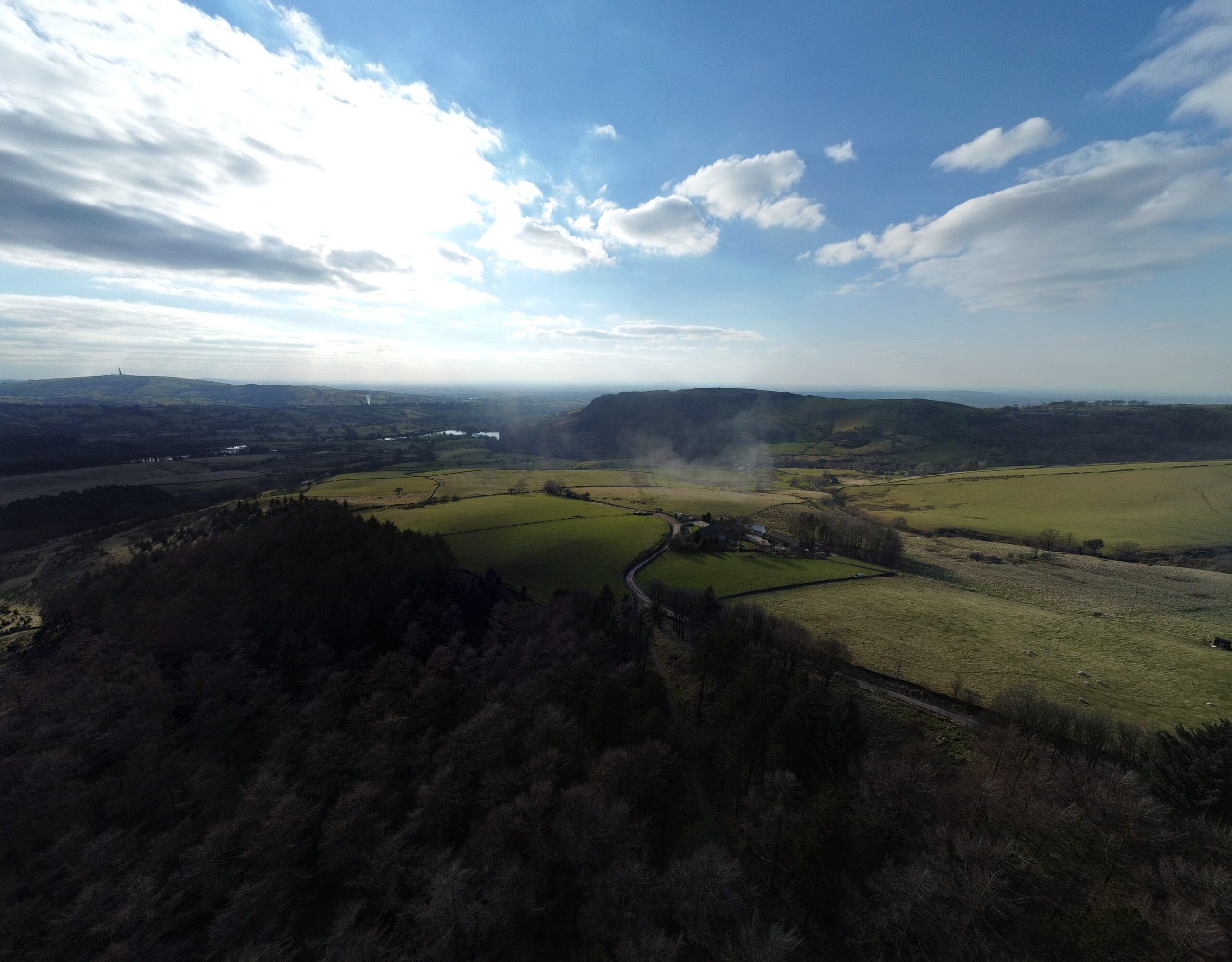
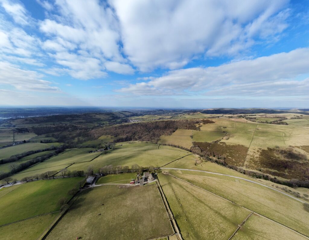
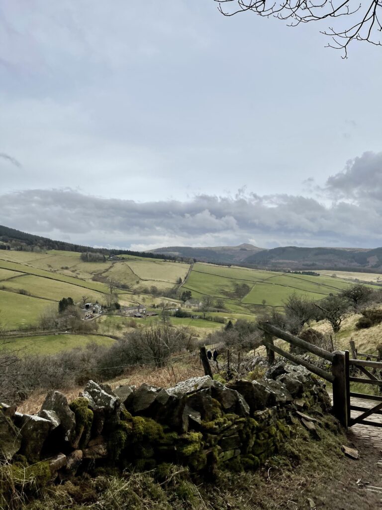
After stopping for a quick lunch break (Han can’t go anywhere without taking a good selection of food), we headed back over towards Tegg’s Nose, to cut through via Macclesfield Forest. Now this is where the hills were crazily steep, I know we keep banging on about it but boy was it a leg burner. BUT the hills were well worth it for the beautiful views and best of all we were lucky enough to have walked an a relatively clear day, so we could see for miles, even to Manchester City Centre 🌇.
MACCLESFIELD FOREST
Macclesfield Forest is located to the east of Macclesfield on the western edge of the Peak District National Park. Interestingly, only about two-thirds of the forest falls within the National Park. About 400 hectares of the forest is designated as a Site of Biological Importance. The woodland – containing pine and broad leaf trees – is also the last remnant of the Royal Forest of Macclesfield. It is owned by United Utilities and with four reservoirs, it is an important water catchment area providing Macclesfield with drinking water.
Throughout Macclesfield Forest you might be able to spot some red deer or rare breed sheep. During the summer months you could even see some longhorn cattle around Tegg’s Nose. The area around Trentabank reservoir is a nature reserve, managed by the Cheshire Wildlife Trust and is home to the largest heronry in the Peak District.
Since the forest has a lot to offer it attracts a great variety of people, including families, walkers, cyclists, mountain bikers, horse riders and even fishermen.
MACCLESFIELD FOREST CHAPEL
This Anglican church is a designated Grade II listed building. The original chapel was built in 1673 before it was pretty much entirely re-built in 1834.
I guess you’re wondering what makes this church so interesting that we have to mention it! So, before churches had stone floors, rushes were used to keep the earthen floors clean. They were collected then strewn together on the ground. These rushes were replaced once a year as part of the rushbearing festival. This tradition ceased once churches were able to have stone floors.
However, this unique rushbearing ceremony is still practiced in a handful of towns in the north of England, and one of them is at this particular Forest Chapel. Pretty cool, don’t you agree?
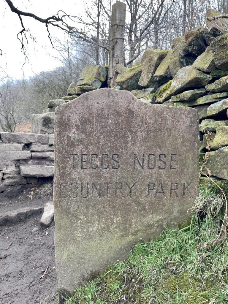
TEGG’S NOSE
Tegg’s Nose was actually quarried for millstone grit from the 16th century until 1955. There were two quarries, one producing a blue stone, and the other producing Tegg’s Nose Pink. It was done by hand until blasting was introduced in the 1930’s. It was very hard work in unpleasant working conditions for very low wages. Many men died from silicosis before they even turned 50.
Today you’ll see a well preserved collection of historical quarrying equipment including a jaw crusher, a crane and a stone saw, which was powered by a steam engine.
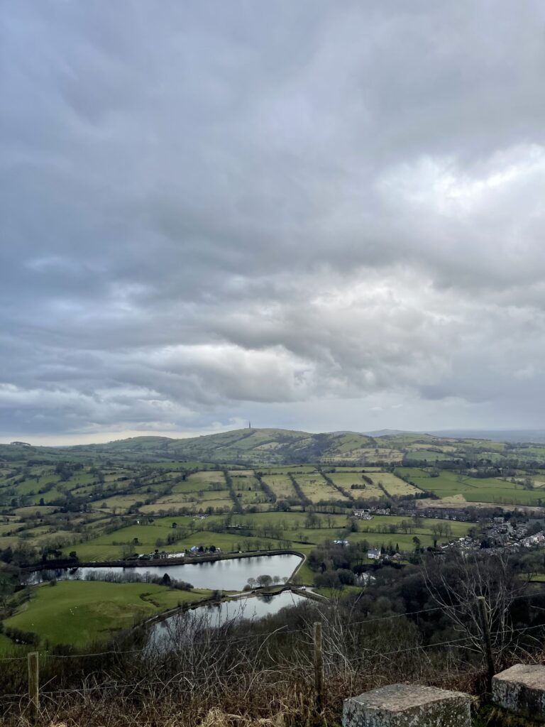
The views at the top of Tegg’s Nose are truly spetacular, so we recommend spending as much time up here as possible. From the top, you’ll see the Cheshire Plain to your right, and on a lovely day you’ll be able to see all the way to Wales. To your left you’ll see the start of the Peak District National Park rising up out of nowhere. You’ll see all four reservoirs that you’ve passed and can trace your finger back along the trail you’ve just completed.
————————-
We decided to also take the drone with us, so we could capture some of these beautiful views from a different perspective. See the video below!
ROUTE DETAILS
- Distance: 6.51 Miles
- Elevation: 1,286 ft
- Time: 2.5 hours
- Parking Postcode: Macclesfield SK11 0AR
Head over to our YouTube channel for more videos, and be sure to check out the other items on the Peak District Bucket List!
HJ Visuals (Han & James)


